Friday, April 19, 2024


BREWSTER – The sky was clear and the air calm last Nov. 17, so Kris Erlandsen and Jesse Revel of Erlandsen & Associates decided to go flying…and they didn’t even have to leave the ground.
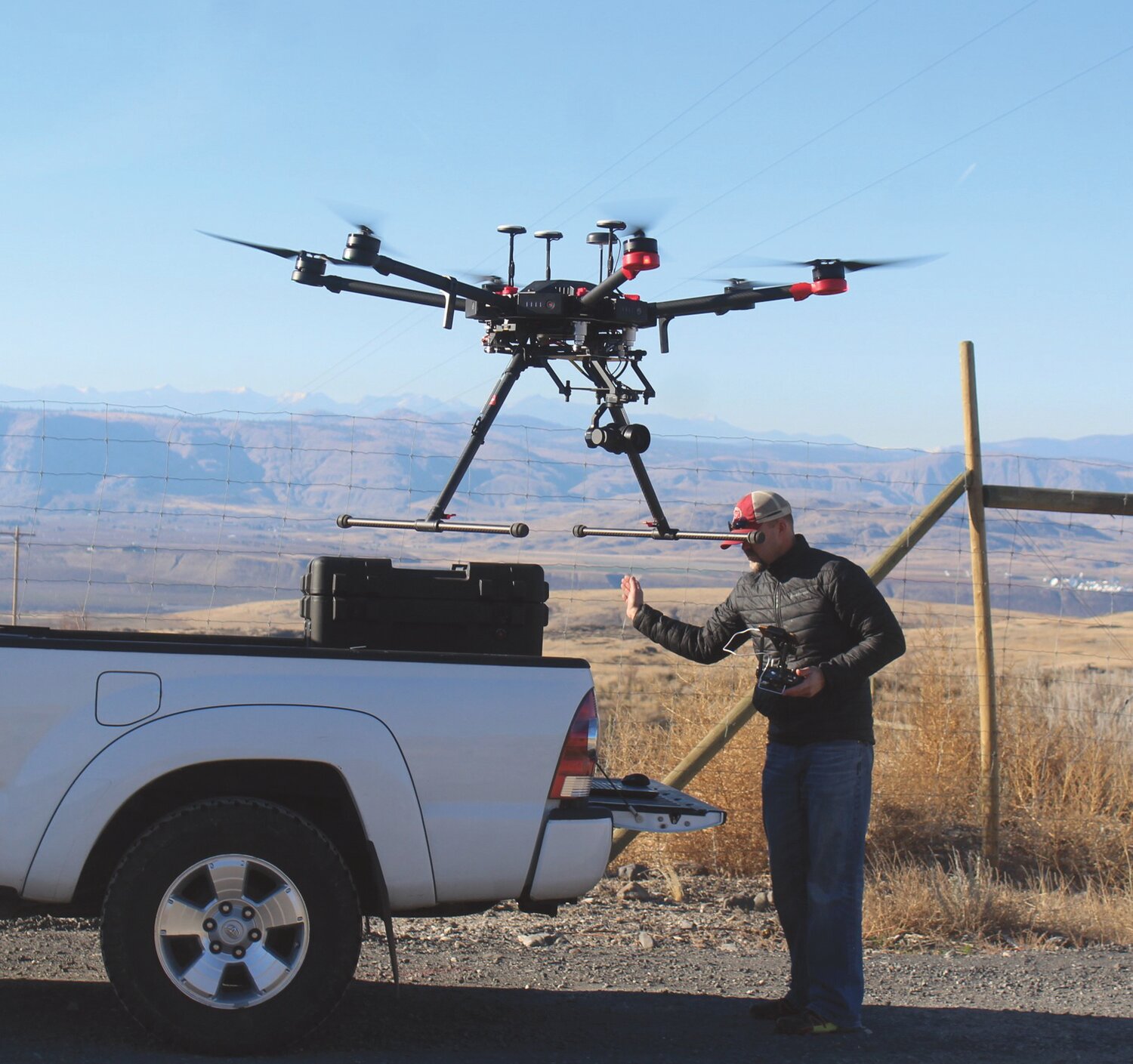
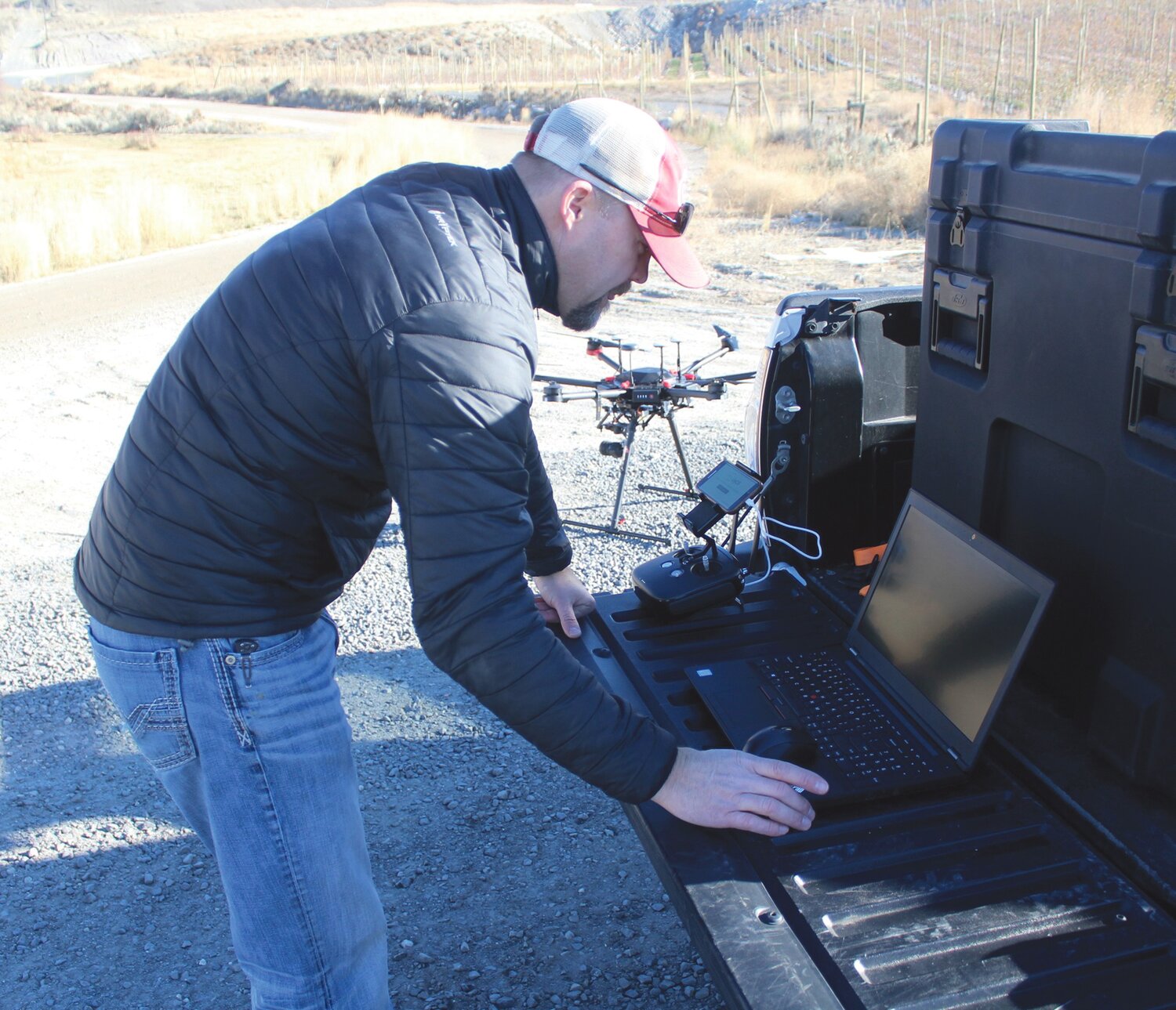
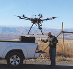
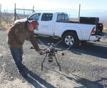
The two specialists with the Brewster surveying, planning, and engineering firm launched a high-tech drone from an abandoned gravel pit along Cameron Lake Road on the Colville Indian Reservation to conduct an aerial survey for the Okanogan County Public Works. The pair was gathering aerial imagery on this trip, having already collected the ground data on previous flights.
“They’re looking at redoing a stretch of road,” explained Erlandsen, “so this is one of the tools in our toolbox.”
Make no mistake, the tool box is high-tech and the pricey six-propeller flying gizmo with a gimbal-mounted camera is cutting-edge.
Drone use is exploding for both recreational and commercial users as the rapidly evolving technology and increasing battery life allows the lightweight aerialists to take on ever-advanced projects.
“Two-and-a-half miles of road would take one of our surveyors a week to collect all the data,” said Erlandsen pointing to the drone, “and these do it in a hour or two.”
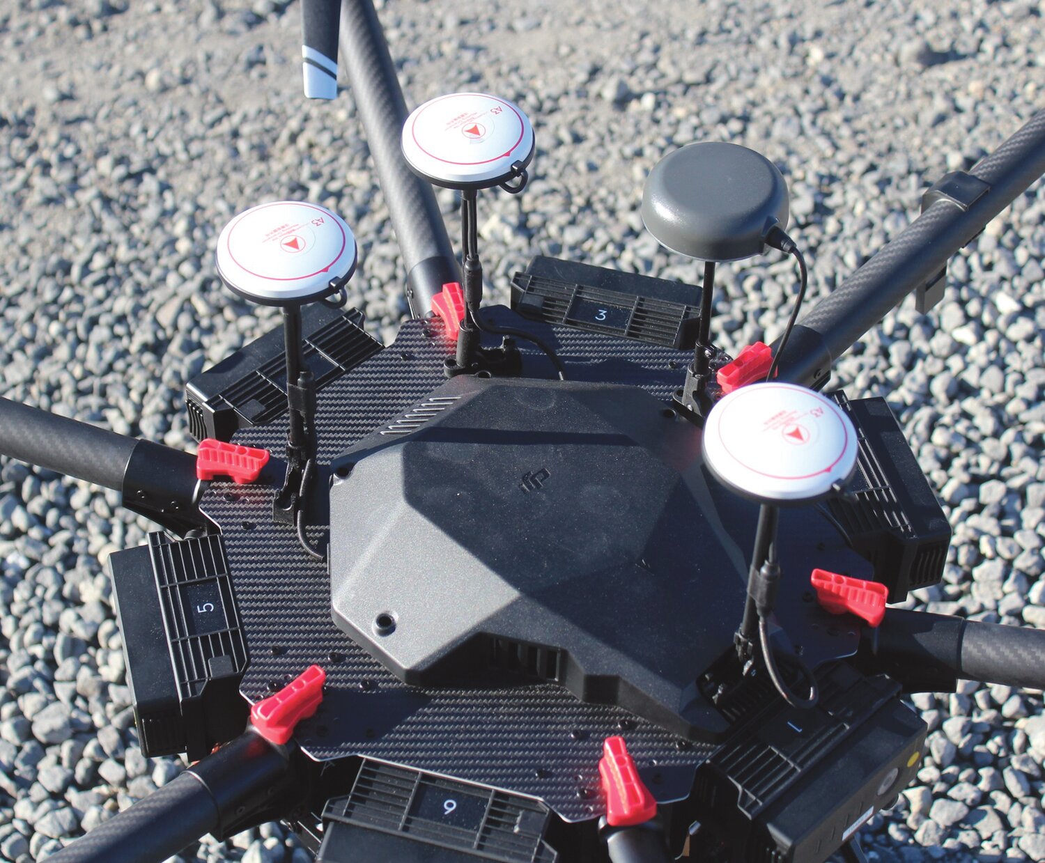
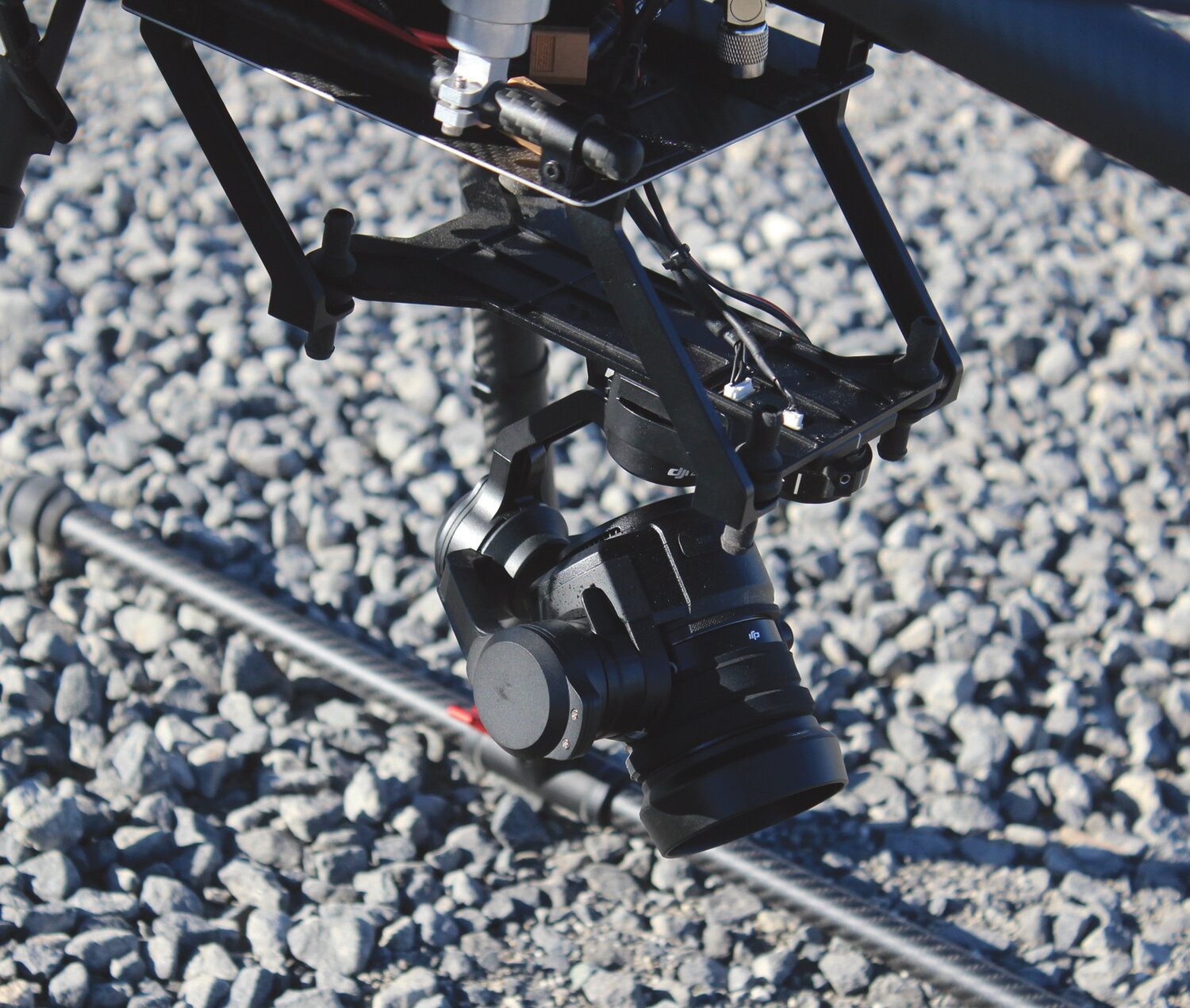
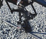
An actual survey of property lines still must be done manually, but the mapping and ground data can now be handled by the drone. The technology used by Erlandsen is called “LIDAR” a composite of light and radar also called Light Detection and Ranging that uses pulsed laser light to measure ranges even through cover like grass and brush. Erlandsen said that translated in one-inch pixels the Cameron Lake Road survey could produce 55 million points of data with a density of some 50-60 points per square meter.
Using six battery rechargeable battery packs that can power the drone for up to 40 minutes, the machine cruises at a maximum ceiling of 120 meters (400 feet). Part of the new technology is the learning curve in the field as operators like Revel, who is a trained land surveyor, make corrections literally on the fly when glitches are encountered that were not envisioned by the manufacturers.
Josh Thomson, Chief Engineer for the county’s public works department acknowledges that drone use is a big-time saver and produces much more data for a given expense.
“We could use this to inventory our pits,” said Thomson of the county’s gravel depots. “We currently survey those with hand-held GPS technology.”
Thomson said the county must be sensitive to property owners and privacy issues when conducting drone work.
“Pend Oreille County just started using one and when they fly a road, they immediately block everything out of their photo area that is private property or not part of their data needs,” said Thomson. “They can then show the public that they are not collecting other than what they need.”
Erlandsen’s company flew a portion of Peter Dan Road near Grand Coulee to survey a landslide when public works was unable to put a person on the still-unstable slope to assess the extent of damage.
Okanogan County Emergency Management (OCEM) Director Maurice Goodall uses drone overflights to survey, monitor, and assess natural disasters such as floods, landslides and other damage spots. Samples of his aerial video can be seen on OCEM’s Facebook site.
Carrying a price tag approaching $250,000, for all the bells and whistles, Erlandsen’s drone is just the beginning for what the company envisions as a major data-gathering arm of its business. In another application, the company is in the development stages of a drone that will conduct multi-spectral imaging to help agriculturalists monitor plant health.
And they even pay the guys for having so much fun.


Comments
No comments on this item Please log in to comment by clicking here